Measuring the size of the Earth
You will need:
•A map of your country or continent with an accurate scale
•A friend at another location as far away from you as possible in a north or south direction
At each location you must have:
•A ruler or measuring tape
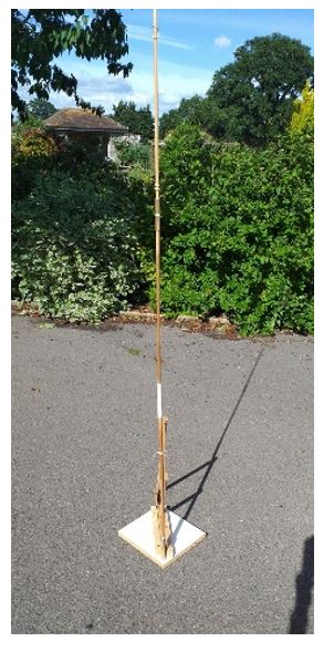
•A straight stick (it can be any length but at least 1.5 m) What you need is the angle A.
•A telephone connection (mobile)
•A compass
•An accurate clock
•It must be sunny
Instructions
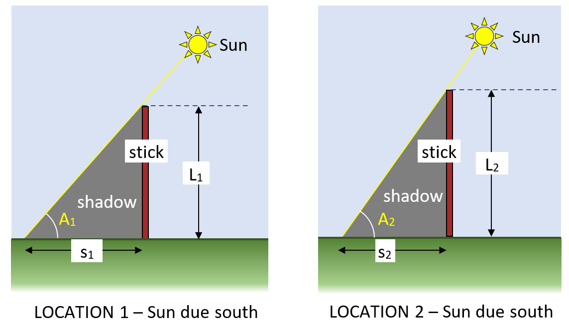
1. Put a stick vertically in the ground at two observing stations (schools) on approximately the same longitude. (The worked example shows schools in Plymouth (A2) and Inverness (A1))
2. Measure the length of your stick above the ground (L1 or L2)
3. Use mobile phones to communicate between the two observing stations so that measurements can be taken at the same time when the Sun is at its highest point in the sky and would then be due south of both observers.
SAFETY: NEVER LOOK DIRECTLY AT THE SUN
When the Sun is at its maximum elevation it will be due south of each observer and the shadow of the stick will be at its shortest. It is at this moment that you need to make your measurements.
4. Measure the length of the shadow of the sticks made by the sunlight at each place (S
1 and S
2)
5. Calculate the angle (A) that the sunlight makes with the horizontal at both locations
Tangent of the angle = L/s Therefore angle = tan
-1(L/s)
You can see from the diagrams that because Inverness (location 1) is 790 km further north than Plymouth the Sun will be lower in the sky than it is at Plymouth (location 2) at the same time.
6. Calculate the circumference of the Earth from your results. Remember that the Earth is not spherical and therefore your result may not be exact.
Data for a possible set of measurements:
Distance from Inverness to Plymouth = 790 km almost due south (Use an atlas to find this for any two locations that are roughly north-south of each other)
Length of the shadow of a vertical metre stick in Plymouth = 70 cm
Length of the shadow of a vertical metre stick in Inverness = 90 cm
Angle that the Sun's rays make with the Earth's surface at Plymouth = 55
o
Angle that the Sun's rays make with the Earth's surface at Inverness = 48
o
Difference = 11
o and this is equivalent to 1250 km.
The difference in the angle is 7
o for the two cities 795 km apart so the distance round the whole planet (360
o) is [360/11] times the distance between the two cities.
Therefore: the circumference of the Earth is [360/7]x790 = 40 630 km.
The accepted value is 40 075 km
You can choose any two cities that are roughly north-south of each other. The closer to exactly north-south they are the better will be the answer.
For this activity assume that the two cities lie exactly north-south of each other. If they do not then a small difference in latitude will not make the result too inaccurate.
I have had to exaggerate the angles and the difference between them in this diagram.