
Look up on a clear night and you may sometimes
see a starlike point of light drifting across the sky. This is probably an artificial satellite.
Since the 1950s many satellites have been put into orbit around the Earth and
others have been launched to explore the Solar System and even go beyond it into deep
space.
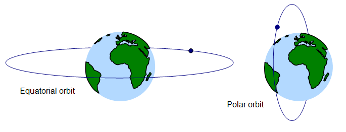
Artificial Earth satellites are usually launched into one of two types of
orbit:
(a) equatorial orbit where the satellite orbits the
Earth above the equator
(b) polar orbit – this means
that the satellite’s orbit passes over the north and south pole
Satellites that orbit the Earth have a number of
uses:
(a) studying crops
(b) military uses
(c) global positioning satellites
(GPS)
(d) observing and forecasting weather
(e) space telescopes for
astronomy
(f) telecommunications (using geostationary satellites)
(a) satellites
can be really useful for studying the health of crops. Images produced by the cameras on the
satellite are analysed by scientists on the ground and give information about the condition of
the crop and the possible size of the crop that year
(b) military uses such a
observing an enemy’s troop movements or photographing hostile weapons systems
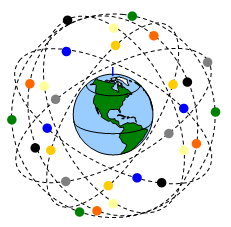
(c) GPS
These satellites are used to
help you find where you are on Earth. The system was completed in the 1990s and there are
now about thirty of these satellites orbiting the Earth in six separate orbits some 20 000 km
above the ground.
The GPS receiver needs to be able to ‘see’ six of these satellites
at once to get a good final signal and so give you a really accurate location.
GPS
receivers are used in many types of transport (you will have probably seen a satnav in a car),
telescopes and by the military, and they can pinpoint your position on the planet within about
20m! They do this by a method similar to triangulation but a bit more complex.
The
GPS system is built up of satellites each with a mass of 1665 kg (about the same as a
medium sized family car) moving at 11200 km/hr (3000 m/s) and making two orbits of the
Earth each day.
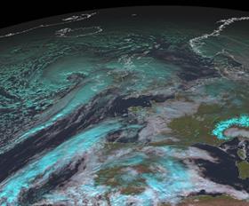
(d) Weather
satellites can be in a polar orbit or one above the equator. They are used to observe the
weather and you can see pictures transmitted by these satellites by using your computer.
(Image copyright 2008 EUMETSAT)
The satellites in polar
orbit are about 850 km above the Earth’s surface and make two orbits a day. At this distance
they can see far more detail than the much more distant equatorial orbit
satellites.
In space they are well above the Earth’s atmosphere and the pictures
taken through them are much better than down on the Earth’s surface where they are
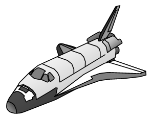
affected by the pollution of the atmosphere. The Hubble space telescope was taken into orbit
by the space shuttle and has been repaired by astronauts from the
shuttle.
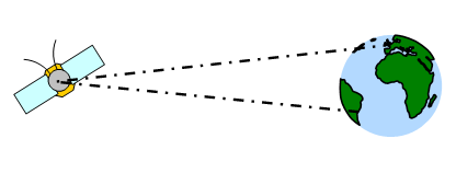
(f) Communication satellites are used to relay radio, TV and
telephone signals around the world. We rely on them if we are phoning a friend in Australia
or watching the 2008 Olympics from Beijing. The satellites used for telecommunications are
called ‘geostationary satellites’because they ‘hang’ at a
fixed point in the sky relative to the satellite dish on the ground. Their name comes from geo
(meaning Earth) and stationary (meaning still).
There are many geostationary satellites and they are all in an orbit 35 880
km (five and a half Earth radii) above the equator. At this distance each satellite takes
exactly one day to orbit the Earth – this means that they stay above the same place as the
Earth rotates beneath them.